According to Vienna City Hall, green areas make up approximately 50% of the city's total area. Parks are proven to improve the mental and physical wellbeing, as well as social inclusion. They improve air quality, reduce noise, regulate temperatures, provide shaded areas and increase biodiversity in cities.
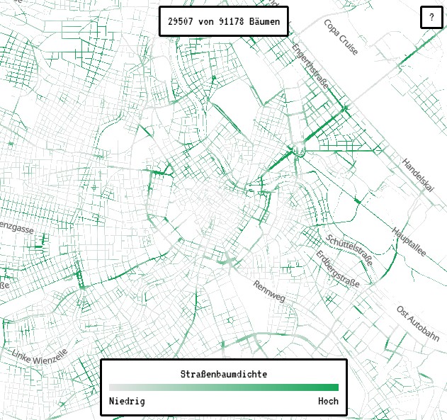
The open source project “Wiener Straßenbäume” ("Vienna Street Trees") tracks roadside trees in Vienna and visualises them in a green heatmap, showing exactly how green Vienna really is.
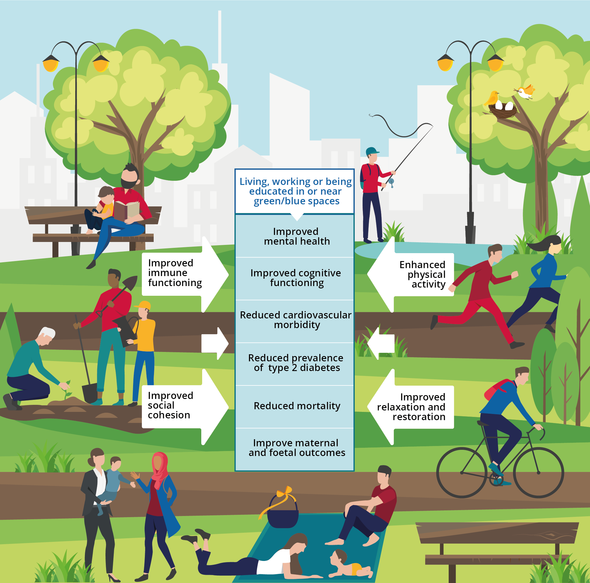
Accessible green areas are especially important for children, the elderly and people with low income. Benefits range from reduced risks of obesity in children, to better heart health and lower rates of depression in adults. However, the accessibility of these areas is not equal in most European cities. Lower income urban neighbourhoods have worse access to parks, playgrounds and gardens. The value of nature within cities is increasingly being recognised by public institutions.
The European Union aims to bring more nature into big cities by 2030 by creating more biodiverse and accessible green infrastructure. EU’s strategy highlights the need to develop urban greening planning in larger cities and towns. The Green City Accord, an EU Commission initiative, aims to make European cities cleaner, greener and healthier, by increasing public green spaces. While institutions are doing their part, the public is engaging in their own way.
One example of how openness can foster civic engagement and environmental awareness is the open source platform “Wiener Straßenbäume” ("Vienna Street Trees"). This open-source project creates a green heatmap documenting over 91,000 roadside trees in Vienna. It offers users both a macro and micro view of the city's tree coverage, highlighting neighbourhoods with dense or sparse tree populations, but also allowing users to explore individual trees in detail. Each tree is catalogued and numbered, with metadata including species, age, height, and the diameter of its trunk and crown.
The platform uses two key open datasets provided by the City of Vienna: the Official Tree Register and the Intermodal Traffic Reference System – Vienna Street Graph (Straßengraph). The official Vienna Tree Register lists approximately 226,000 trees across the city. It supplies data on roadside trees, but also some trees located in parks and wooded areas. Municipal Department 42 (Parks and Gardens), which manages the Tree Register, indicates that all street trees are included in the dataset. Meanwhile, the street graph provides a topological model of Vienna’s road network, enabling spatial analysis and visualization. Street names are taken from openmaptiles and openstreetmap.
Wiener Straßenbäume is not the first or only example of an open source project branching into environmental awareness. Gieß den Kiez, developed by CityLAB Berlin, is a collaborative open source tool designed to help citizens keep trees in their neighbourhoods healthy during dry periods. While the project was launched to help combat the impacts of climate change, it also is a model of citizen participation that shows how mobilising users can contribute to collaborative software development.
Open source makes it possible for solutions like Wiener Straßenbäume and Gieß den Kiez to be developed, copied and scaled very quickly, creating new ways for public agencies to engage with citizens and for citizens to engage with nature.