This report in form of presentation comprises a benchmarking research performed by Gartner on "Location Intelligence".
Location intelligence can be defined as "the process of deriving meaningful insight from geospatial data relationships –people, places or things."
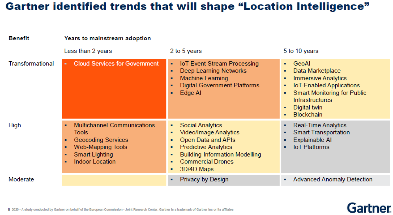
Apart from definitions, the research provides a technology landscape outlining the technological trends that could shape Location Intelligence future.
The study also proves that Digital Transformation of Government can leverage Location Intelligence in several ways:
- Maximising community and ecosystem collaboration using geospatial and location data and services by developing a GIS data exchange, spatial- and location-based mobile apps and map-based public services.
- Engaging stakeholders in planning and policy development by leveraging 4D GIS capabilities to enrich communication of impacts to constituents and partners.
- Driving data-driven decision making that uses spatial data by leveraging GeoAI to develop proactive and predictive map-based models
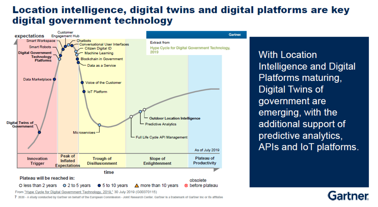
From a study conducted by Gartner on behalf of the European Commission - Joint Research Center.
From a study conducted by Gartner on behalf of the European Commission - Joint Research Center.
It also showcases four different real case studies that use location intelligence (often combined with Artificial intelligence) to support the digital transformation of government. More specifically:
- City of Guimarães: Urban Platform;
- Helsinki: Digital Twin City Models;
- Flanders Region: KLIP Cable and Pipeline Information Portal and
- AsistenciaCovid19: Self-diagnosis and symptom tracking.
Categorisation
Type of document
Document
Licence
Creative Commons Attribution 4.0 International (CC-BY-4.0)
Login or
create an account to comment.