[Return to ELISE's Innovative use of location data and technology to improve public services page]
This report is the state of the art overview of the project " Innovative use of location data and technology to improve public services" funded by the framework of the ELISE Action of the ISA2 Programme to explore and better understand how location data and technologies can help to deliver better public services at the local and regional levels, creating value for citizens, businesses and governments alike.
The study considers many factors, including interoperability, user-centricity, innovation and maturity, replicability and scalability, amongst others.
The report "Leveraging the Power of Location Information and Technologies to Improve Public Services at the Local Level. State of the Art report" contributes to the broader project by providing a state of the art overview of location data and technology applied to improve public services of local and regional governments.
A general overview highlights the policy relevance of the research, situating the study in the broader landscape of EU digital government initiatives, including the Infrastructure for Spatial Information in the European Community (INSPIRE) Directive launched in 2007 up to the more recent Open Data Directive, 2019.

Through complementary methods such as: extensive literature review, desk research, in-depth interviews, and a quantitative survey, the report provides evidence on how location data and technologies are being leveraged to improve innovations that are being implemented, stakeholders involved, the expected value gained, drivers and barriers.
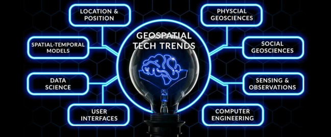
The report guides the reader through the evolution of location data from traditional and mainstream technologies to current innovations and future trends.
One highlight of the report is the significant increase in traditional static location data sets, as well as a rise in dynamic location data sets (Internet of Things (IoT) data, Mobile Positioning Data (MPD),user-generated data, among others). These dynamic data sets can be valuable for gaining location intelligence and supporting public service innovation.

Some of the interoperability barriers mentioned in the report are data ownership, the human and computing capacity required to process and analyse this data, data privacy and ethical considerations. Also the capacity of local and regional governments to maintain up-to-date and high-quality location due to a lack of available resources, civil servant capacity and institutional incentives.
Finally, the report recommends steps to move forward on the legitimacy of using location data for a certain public service and reflects on the potential of immersive technologies to change the ways civil servants and citizens interact with location data.
Download the report here.
How to cite this report: Barker L., Claps M., Stevens R., Crompvoets J., Nasi G. and Vandenbroucke D.Leveraging the Power of Location Information and Technologies to Improve Public Services at the Local Level -State of the Art Report,Schade S. (ed.),Publications Office of the European Union, Luxembourg, 2021, ISBN 978-92-76-41900-6, doi:10.2760/158709, JRC126562.

