Sistema Informativo Territoriale Città metropolitana di Bari (E-GOV 2 Servizi interattivi)
Re-use kit available to public authorities for the management and publication of maps and urban planning tools.


Description
The SIT Metropolitan City of Bari is a territorial information system.
(SIT) represented by a set of IT tools designed for
describe and analyse elements, events and phenomena related to the
land surface. SIT technology integrates into a single environment:
most common operations linked to the use of databases (queries – queries —
statistical analysis, etc.) with the benefits of the geographical analysis
the use of maps is permitted. This particularity distinguishes
SIT from other information systems and makes it a powerful
a tool that can be used by multiple private and public actors, for
bakering events, predicting results and defining strategies. The SIT
allows you to create maps (badges), integrate information, view
scenarios and development of real solutions that can be expressed both in form
maps in qualitative and quantitative form. The evolutionary services of the SIT
they were implemented with funding from PON METRO 2014-2020
— Axis 1 ‘Digital Agenda’ with projects EGOV-2 ‘Interactive services for
the Metropolitan City of Bari’ (CUP: J91J17000110007 local code
ba.1.1.1.a) and ‘Digital transition: spatial information systems and maps’
(CUP: J91F23001250005 local code ba.1.1.1.l) with the aim of promoting full
digitalisation of administrative processes and expanding the offer of
digital services with cross-cutting platforms supporting the area
metro. The SIT for the Area Vasta Metropolis Terra di Bari is composed of:
a Front Office module and a Back Office module for the purpose
as follows: Purpose of the FRONT module OFFICE The module of
front office is a web application that enables citizens and citizens
operators of municipalities of:
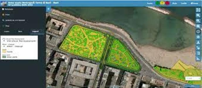
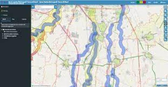
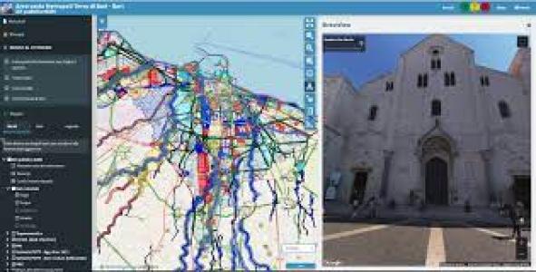
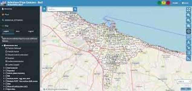
• consult the map layers by overlapping and querying the different information layers;
• update the cartographic and alphanumeric data that make up the cartographic layers;
• print extracts from maps with their legend and carline;
• consult cadastral data and related legislation;
• generate the pro-forma Urban Destination Certificate (CDU).
Purpose of the BACK OFFICE module
The back office allows for the simultaneous management of multiple entities and allows for their own customisation. The back-office module is a web application, for the exclusive use of the Body and allows the management of:
• The map database;
• The publication of maps;
• Management of users and groups with access to projects and functionalities;
• Customisation of the content of the front-office system;
• Updating of cadastral data and legislation;
• Preparation of the templates for the printing and production of the UCC;
• Catalogue and metadata management.
Features
- Geodatabase;
- Map Server Module (INSPIRE-RNDT compliant);
- Access portal;
- WebGIS client module;
- Map Project Management Module;
- Search widget module;
- Regulatory Management Module;
- Form for the management of the cadastral census;
- Metadata Management Module (INSPIRE-RNDT compliant).